Trailside Services are now part of CT Trail Finder!

Tinkerville Brook

Tinkerville Brook Trail offers some of the biggest black birch trees in the area as well as the remains of an old mill on Tinkerville Brook.
Trail Activity
Hiking
Length
1.2 miles, Loop
Difficulty
Easy
Town
Ashford
Surface
Packed Earth/Dirt
Pets
Permitted on leash
Fees
No

Description

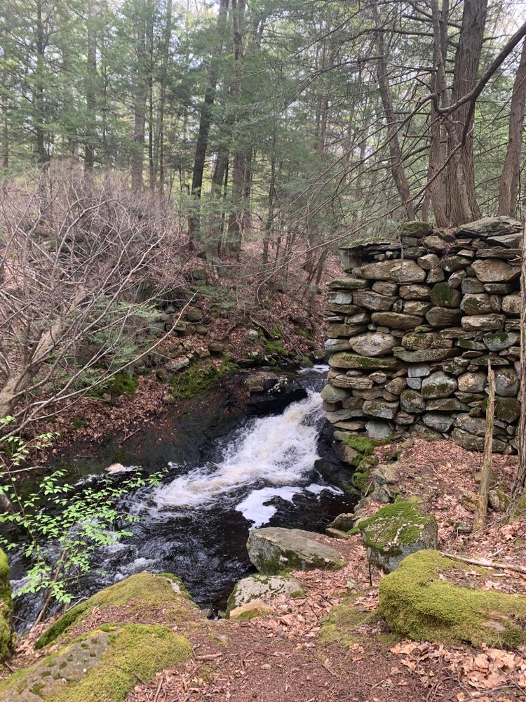
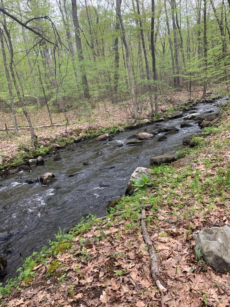
This preserve lies mostly in a narrow strip extending nearly 0.7 miles from Armitage Road to Bissonette Pond. Major features include Tinkerville Brook itself, approximately 7 acres of herbaceous/shrub wetland, a portion of a stand of unusually large black birch, a former gravel pit, an active beaver colony adjoining the brook, an old mill site plus a massive stone bridge abutment, a ravine shaded by mature hemlocks, and a variety of plant and animal resources which have been relatively undisturbed for years.

Other Information

Rules

  • Park in designated areas only.
  • Stay on marked trails.
  • Respect other users.
  • Carry out what you carry in.
  • Do not cut or collect living plants.
  • Help protect all natural and cultural resources.
  • Keep your pet leashed.
  • No fires allowed.

This property was donated to Joshua’s Trust by C & M Associates. It is a portion of a 270 acre subdivision and satisfies the open space requirements of the town of Ashford. This preserve is part of the Fenton River Greenway, a tri-town effort to protect land on both sides of the Fenton, including its tributaries, their headwater streams, and water bodies.

Trail Manager

Joshua's Trust preserves natural habitats and heritage sites in northeastern Connecticut. To learn more contact:

Joshua's Trust
Joshua's Trust
624 Wormwood Hill Road
Mansfield Center, CT 06250
860-701-8035
View website

Trail Tips

Be Considerate of Other Visitors
Respect other trail users and be courteous when passing.
Legend
Hide All

Trailhead Information

From the intersection of Route 89 and Route 44

From the intersection of Route 89 and Route 44 in Ashford, go north on Route 89. Turn left at the stop sign when Route 89 takes a sharp left turn. At 5.2 miles where Route 89 makes a sharp right turn, go straight onto Turnpike Road. Continue 0.6 miles and turn right onto Armitage Road. At 0.7 miles, look for the preserve sign on the left. Park near the gate.

Click on a parking icon to get custom directions
Please Log In or Create Account to add comments.
Add a Service
Find businesses and organizations that are located around this trail that support adventuring outdoors!
Legend
Hide All
Hide All
No services shown. Try zooming out.
Hang Tight!
Nearby services are loading
SHARE THIS TRAIL
PRINT THIS TRAIL

Add Trail Log

Please wait…
Join In on the Fun!
Log in or create an account below to unlock all the great features of Connecticut Trail Finder: keep track of trails you want to do, preserve memories of trails you’ve done, and more!
Your log in attempt was not successful. Please try again.
    Lost your password? Reset your password
    Don't yet have an account?
    There was an issue with your submission. Please try again.
      * Indicates required field
      Already have an account? Login here
      Enter your username, and we will send you a new, randomly generated password to your email account.
      There was an issue with your submission. Please try again.

        Success! A new password has been emailed to you.

        Log in now

        Please wait…