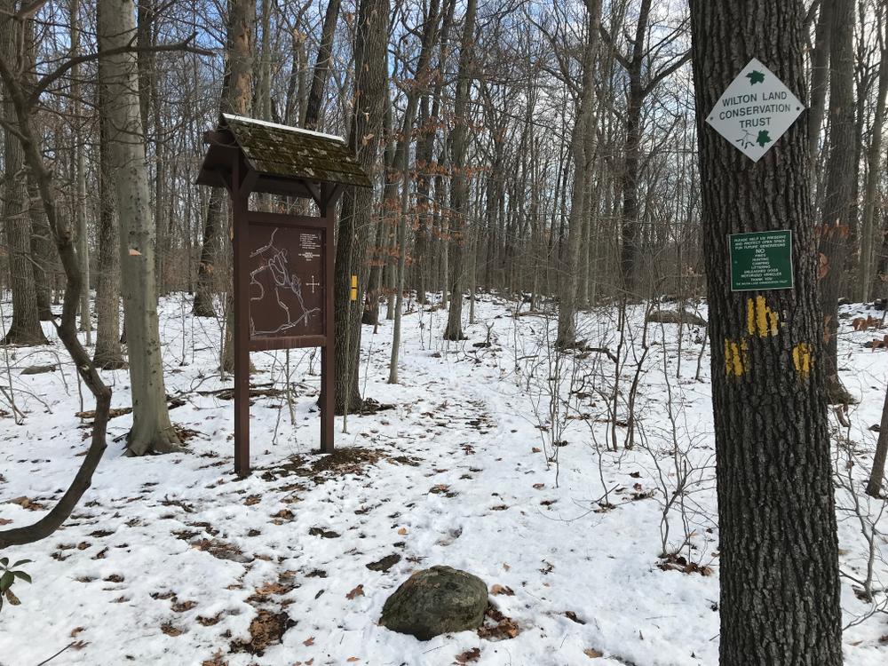
The yellow-blazed access trail begins just south of the parking area at the top of the driveway. This trail winds its way south through a young forest of deciduous hardwoods. The yellow trail ends at a wide stonewall, where it intersects with the orange trail. Turn right to connect to the orange northern trail. This trail crosses the wetland system that lies in the Huckleberry Hills valley. A springtime visit reveals that much of this area is flooded by seasonal water.
Boardwalks and stepping stones help walkers cross the wettest spots. Sensitive fern, skunk cabbage, jack-in-the-pulpit, and marsh fern cover the wetland floor in the summer months. This trail connects to the northern portion of the Marble/Van Haelewyn Preserve and intersects with its red-blazed trail. From here one can continue along trails within the Marble/Van Haelewyn - Richards Preserve and loop back to the trail entrance at Sackett.
A left turn at the end of the yellow access trail will put you on the orange southern trail. After winding through a wetland plateau thick with shrubs and spicebush, this trail rises up to a bedrock ledge that overlooks the large wetland valley to the west. The exposed bedrock is a mafic gneiss, ancient ocean-bottom sediments that underwent metamorphism hundreds of thousands of years ago.
At the high point of the trail, there is a great view west of the wetland valley and the Marble/Van Haelewyn Preserve. The trail turns east off of the ridge onto a flat upper plateau. Exposed rocks and thin topsoil support an open canopy of beech, chestnut oak and scarlet oak. The thin, dry and acidic topsoil keeps the shrub layer at a minimum, making an airy open walk through the woods. The blue southern trail continues west into the Richards Preserve. With the approach to the wetland valley, notice the increase in other tree species, such as red oak, black birch and tulip trees.
As soil moisture increases there is also an increase in shrubs and ground cover. A springtime walk will reveal beautiful forest floor of maple-leafed viburnum, swamp azalea, wild geranium, and hay-scented fern. From this point one can either turn back and return to the trail-head or continue on the wonderful trails of the Land Trust's Marble/Van Haelewyn - Richards Preserve. A very enjoyable loop, on trails on each of the three properties, can be followed around the perimeter of the Huckleberry Hills wetland valley.
Mountain bikers should not ride when trails are wet or muddy to avoid skidding. Hikers and walkers have right-of-way. No trail braiding or trail modification, mountain bikers stay on designated trails.
To report an issue on the trails, please use SeeClickFix (select Trails under Submit a Request).

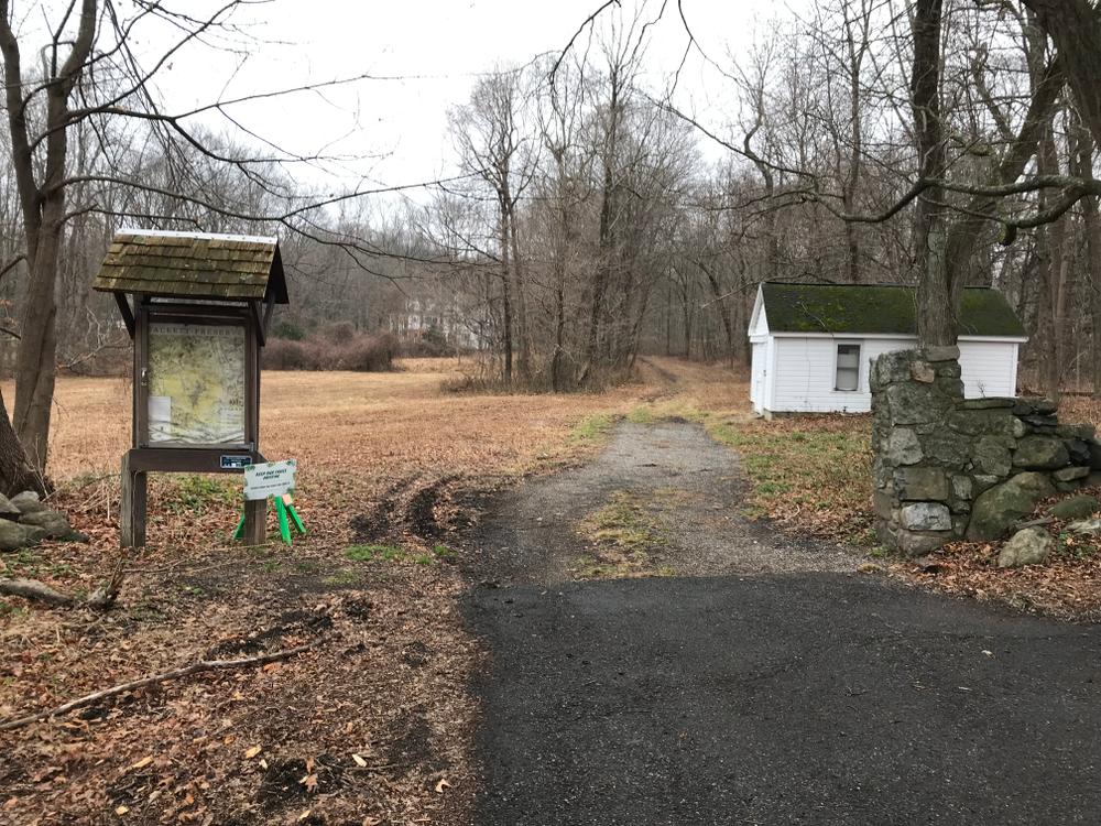
From the Wilton Center, go west on Ridgefield Road (Route 33) for 2.2 miles to the driveway entrance on the west (left) side of the road, just before Route 33 intersects with Deforest Road. There is a parking area at the top of the driveway.
Take Ridgefield Road from Wilton Center to Deforest Road. Make a left onto Deforest Road. Follow Deforest Road to Crofoot Road. Turn left onto Crofoot Road. Follow Crofoot Road to Abbott Lane. Take a left onto Abbott Lane. Follow to the end of Abbott Lane. Street parking only.
Take Ridgefield Road from Wilton Center to Deforest Road. Turn left onto Deforest Road. Follow Deforest Road for approximately 0.42 miles. Entrance on right side of the road. No Parking.
Take Ridgefield Road from Wilton Center to Drum Hill Road. Follow Drum Hill Road to Cheese Spring Road. Take a right onto Cheese Spring Road. Follow Cheese Spring Road for approximately 0.68 miles. The entrance is on the right. No Parking.
Success! A new password has been emailed to you.