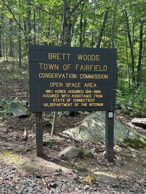
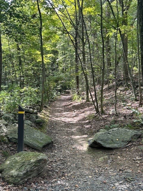
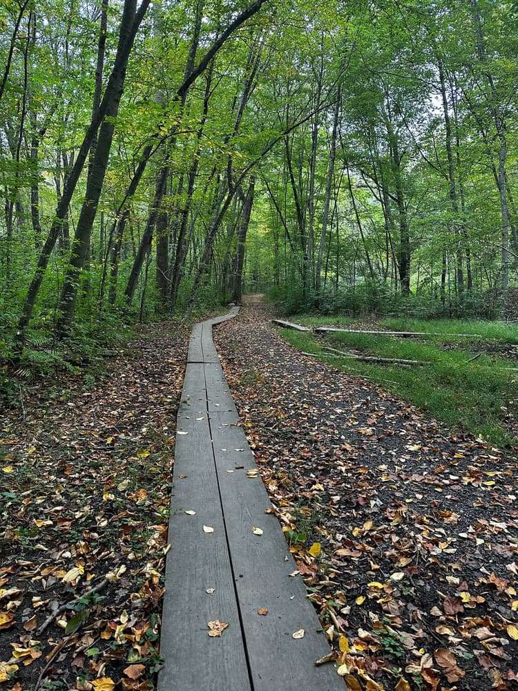
Brett Woods has an extensive trail system. Many of the trails follow the contours of the land, roughly paralleling the ridge and valley system. In some instances, however, the trails cross directly over the ridge line as does the trail that follows the old North Street roadbed. Surface conditions on the trails include bare mineral soil, wet or moist soil, loose gravelly surfaces, ledge outcrops, and grassy areas. The trails vary in length, condition, and degree of difficulty so take care when hiking.
The Yellow perimeter trail is almost two miles long. The Red Trail cuts diagonally across the property and is about 1¼ miles long. The Blue Trail is shorter at about a ½ mile and passes through the camping area.
Turn east onto Treasure Road; keep going to the end of the road, parking is across the intersection with Gilbert Highway, between 225 and 365 Gilbert Highway. Additionally, another access point can be accessed by turning east onto North Street (in Weston); keep going to the very end of the street to find a small gravel parking lot between 3701 and 3756 North Street (Weston).
Take exit 17 and head north on Saugatuck Avenue (Route 33); continue on Riverside Avenue past the intersection with Route 1 and continue on Wilton Road, then take the next right to cross the river on Kings Highway North and continue on Canal Street Turn left onto Main Street. At the 4-way intersection, go straight to continue on Easton Street for approximately 3 miles.
Take exit 42 and go south on Weston Road for a short distance, then turn sharp left/north onto Easton Road/Route 136 and continue for about 3 miles.
Turn west onto North Street (Fairfield) for a small gravel parking lot at the west end of North Street (just past cul-de-sac). Another access point can be found by turning west on Fallow Field Road, a pedestrian only trail starts at the corner of Mulberry Hill Road and Fallow Field Road - no parking.
Take exit 44 and turn south onto Black Rock Turnpike, then immediately turn right/west onto Congress Street. Follow Congress Street for about 3 miles, then turn left onto Brett Road, and take the second right onto Redding Road.
Take exit 20 and turn right/north onto Bronson Road for about 2 miles. Take a left on either Hulls Farm Road or Governors Lane and turn right again onto Redding Road.
Take exit 18 and turn left onto Sherwood Island Connector towards Route 1. Turn right onto Route 1/Post Road for 1.3 miles, then turn left onto Maple Avenue North. After 0.7 miles, turn right onto Long Lots Road. Continue on Long Lots and then Hulls Farm Road until you hit Redding Road (1.5 miles), then turn left onto Redding Road.
Success! A new password has been emailed to you.