Over 2000 miles of trails on CT Trail Finder, and many more to come!

Putnam Memorial State Park

This is the print view for this trail. View the full trail posting.

Create a hands-on history lesson with a visit to Putnam Memorial State Park, site of the Continental Army's 1779 winter encampment in Redding, Connecticut. Hike the networking trails with friends and family.
Trail Activity
Hiking
Length
4.5 miles, Network
Difficulty
Easy, Moderate
Town
Redding
Surface
Packed Earth/Dirt, Grass, Paved/Cement
Pets
Permitted on leash
Fees
No

Description

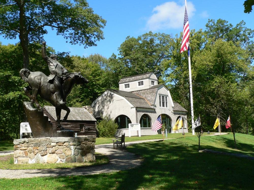
This park has a rich history connecting back to the revolutionary war. This was the site of the Continental Army's 1779 winter encampment under the command of General Israel Putnam. The site consists of remains of the encampment, reconstructed log buildings, and a museum.

Paved roads and packed dirt trails are available for those who prefer a flatter surface. Historic sites dot the trails throughout the park. Putnam State Park also offers interpretive hiking areas. 

The Friends and Neighbors of Putnam State Park offer many opportunities to learn more about the park's history and cultural attractions. 

Other Information

Trail Amenities

  • Toilets, picnic tables, museum.
  • Accessible parking.
  • Youth camping on site.

RUles

  • The park is open from 8 am to sunset.
  • Pets on a leash are permitted in picnic areas and on hiking trails.

Trail Manager

This park is managed by the following CT DEEP Park Headquarters:

CT DEEP: Putnam Memorial State Park
499 Black Rock Turnpike
Redding, CT 06896
(203) 938-2285
https://portal.ct.gov/deep/state-parks/listing-of-state-parks

Trail Tips

Travel and Camp on Durable Surfaces
Stick to established trails and campsites. If there's no trail, try to walk on rock, gravel, or snow and spread out so that your group doesn't create a trail.

Trailhead Information

Park Location: Intersection of Route 107 and Route 58, Redding, CT

Directions
Off I-95

From I-95, take Exit 17. Take Route 136 north for 9 miles. At the intersection of Route 136 and Route 58, take Route 58 north and drive 8.8 miles. Putnam Memorial is at the intersection of Route 107 and Route 58.

Off the Merritt Parkway Southbound

From Route 15 (Merritt Parkway), take Exit 42. Take Route 136 north for 5.2 miles. At the intersection of Route 136 and Route 58 take Route 58 north and drive 8.8 miles. Putnam Memorial is at the intersection of Route 107 and Route 58.

Off the Merritt Parkway Northbound

From Route 15 (Merritt Parkway) take Exit 44. Take Route 58 north for 12.4 miles. Putnam is at the intersection of Route 58 and Route 107.

From the East 

From I-84 West take Exit 10. Go right off the exit and follow to Route 25 south. Take a right onto Route 302 west and follow for approximately 6 miles to Route 58 south. Take a left onto Route 58 and follow south for 2.8 miles. Putnam Memorial is at the intersection of Route 58 and Route 107.

From the West 

From I-84, take Exit 10. Go left off the exit and follow to the Route 25 south. Take a right onto Route 302 west and follow approximately 6 miles to Route 58 south. Take a left onto Route 58 and follow south for 2.8 miles. Putnam Memorial is at the intersection of Route 58 and Route 107.

Legend
Hide All
Join In on the Fun!
Log in or create an account below to unlock all the great features of Connecticut Trail Finder: keep track of trails you want to do, preserve memories of trails you’ve done, and more!
Your log in attempt was not successful. Please try again.
    Lost your password? Reset your password
    Don't yet have an account?
    There was an issue with your submission. Please try again.
      * Indicates required field
      Already have an account? Login here
      Enter your username, and we will send you a new, randomly generated password to your email account.
      There was an issue with your submission. Please try again.

        Success! A new password has been emailed to you.

        Log in now

        Please wait…